大吹峠~松本峠
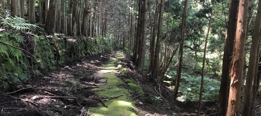
無事に猪をやりすごして、峠を下っていきます。石畳の舗装も整ってきました。ただ、誰一人すれ違うことも、追い抜くこともなく、一人で歩いているのに変わりありません。途中、廃墟となった小屋がいくつか並んでいました。
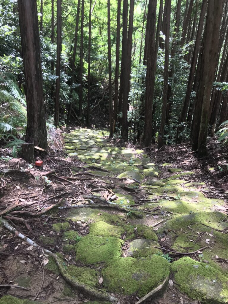
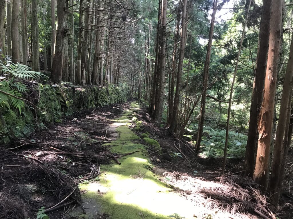
道は緑の苔がみっしり生えていて風情がありますが、気を付けないと滑りそうです。ここは峠の登り口で借りてきた杖が活躍します。大吹峠の大泊側の登り口で杖を返して、ようやく1つの峠を越えることができました。
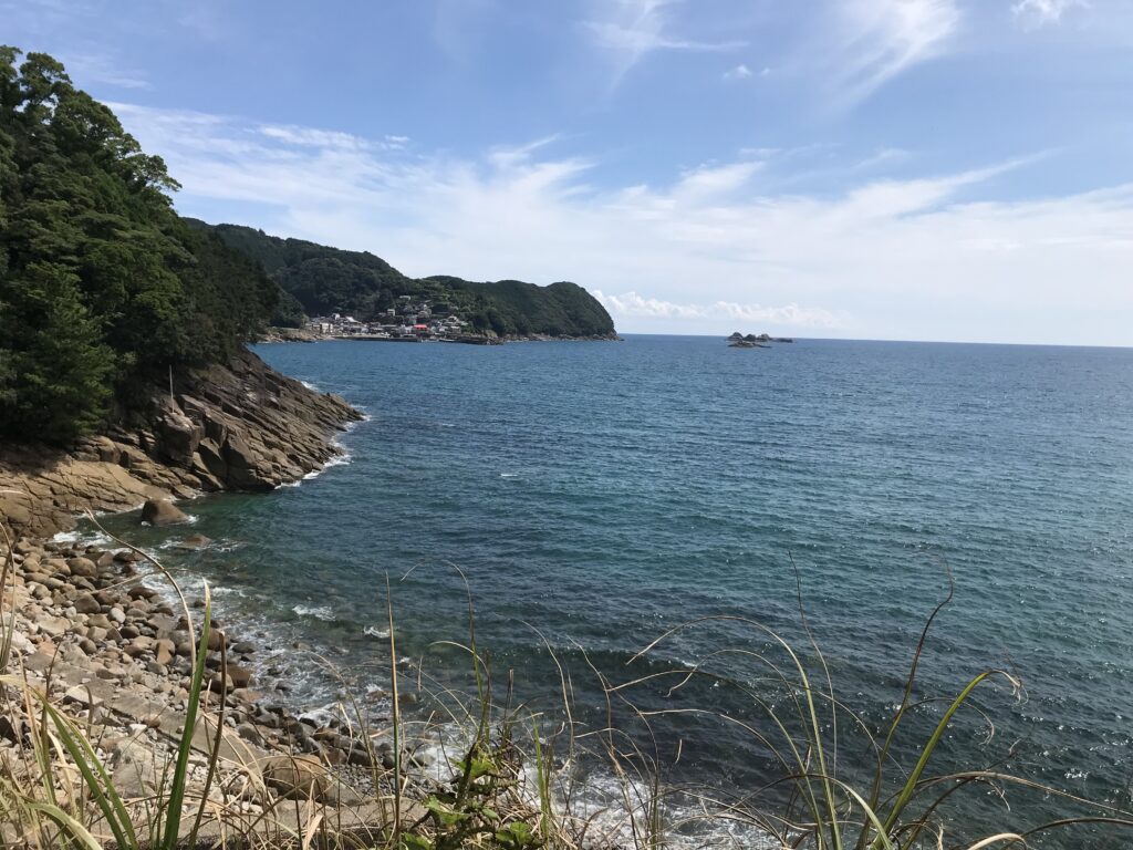
海岸線をゆく
次に松本峠に行くまでに観音道を歩きます。舗装された道なので足にも優しいです。少し下っていくと再び海が見えてきました。その海岸線に沿って道路が走っており、ビーチで高校生たちがふざけ合っているのが見えます。
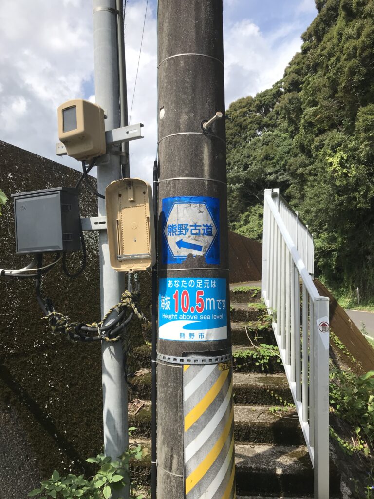
ふと電柱を見ると足元が海抜何メートルか掲示されています。今の海が穏やかでも、この先、いつ南海トラフ地震が発生するのか誰にもわかりません。その時、津波がすぐにやってくるでしょうから、常日頃からの注意喚起が必要だと思いました。
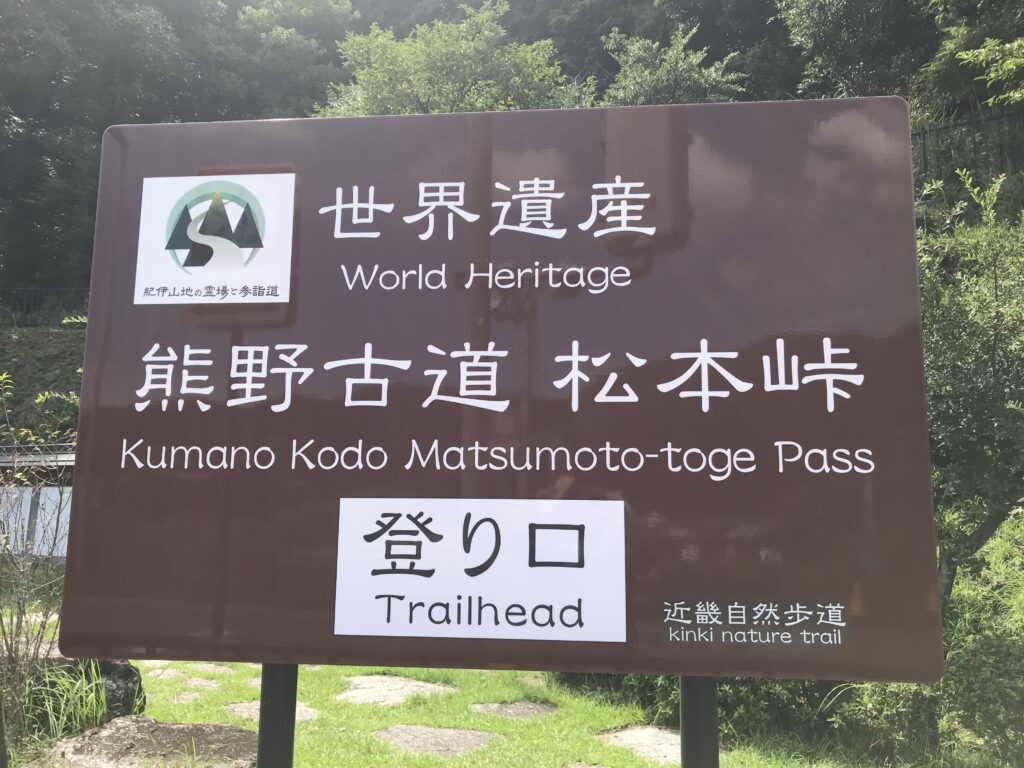
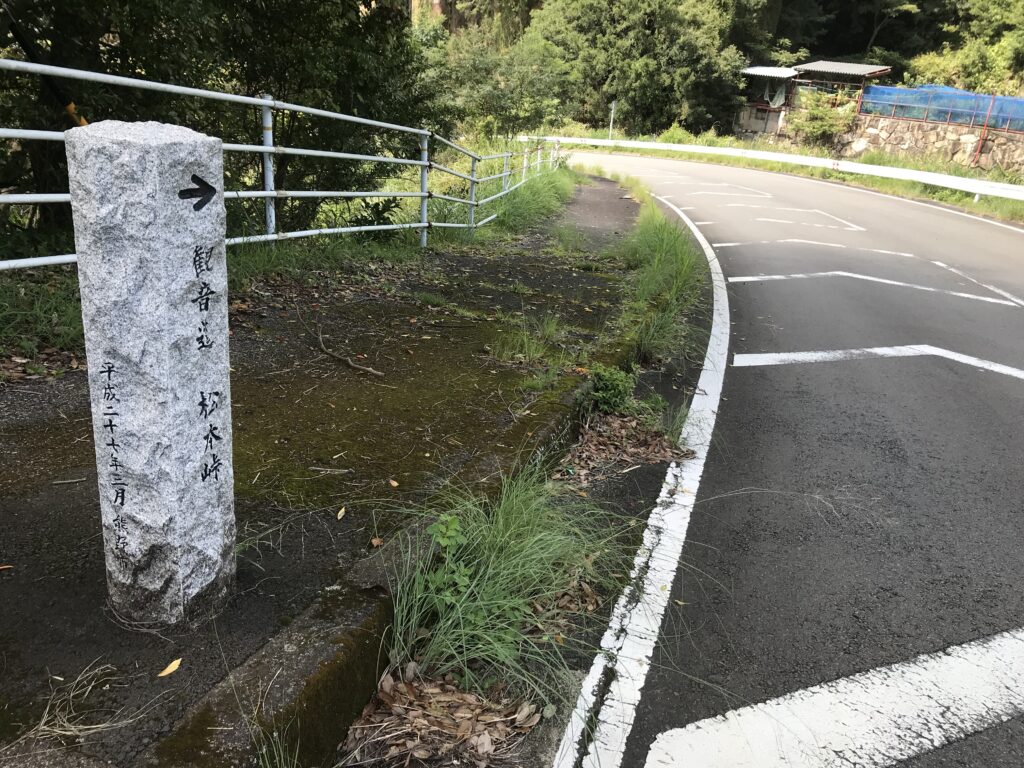
松本峠の登り口へ
いま歩いているところから高台に行くにはかなり走らないと危ないなと思いながら、ビーチを超えて松本峠に続く坂道に差し掛かりました。いよいよ2つ目の峠、松本峠の標識が目に入ってきました。(つづく)
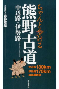
伊勢路を歩く際に役立つ本
一人で歩くとなると地図だけでなく、詳細なランドマークが記載されたルートマップがあると心強いです。東海道、中山道でも同シリーズを出版している山と渓谷社のマップを今回持参しました。
価格:1,650円
(2021/5/1 16:29時点)
感想(4件)
Ise Road 2 (English)
Obuki Pass – Matsumoto Pass
After safely passing the boar, I headed down the pass. The cobblestone pavement is now in place. However, no one was passing me or overtaking me, so I was still walking alone. Along the way, I saw a few abandoned huts lined up.
The path was covered with green moss, which made it look charming, but it was also slippery if you were not careful. This is where the walking stick I borrowed at the entrance of the pass comes in handy. I returned the walking stick at the Otomari side of the pass and finally crossed the pass.
Going along the coastline
Next, I walked along the Kannon Road before reaching Matsumoto Pass. The path is paved, so it’s easy on the feet. A little further down the road, the ocean came into view again. The road runs along the coastline, and I could see high school students joking around on the beach.
When I look at an electricity pole, I see that it is posted how many meters above sea level the foot of the pole is. Even if the sea is calm now, no one knows when the Nankai Trough earthquake will hit. At that time, tsunamis will probably come soon, so we need to be alert on a regular basis.
To the top of the Matsumoto Pass
Thinking that it would be dangerous to run fast to reach the high ground from where I was walking, I crossed the beach and approached the slope leading to Matsumoto Pass. Finally, I saw the sign for the second pass, Matsumoto Pass. (To be continued)
Route d’Ise 2 (Français)
Col Obuki – Col Matsumoto
Après avoir passé le sanglier en toute sécurité, je me suis dirigé vers le bas du col. La chaussée pavée est maintenant en place. Cependant, personne ne me dépassait ou ne me doublait, je marchais donc toujours seul. En chemin, j’ai vu quelques cabanes abandonnées alignées.
Le chemin était recouvert de mousse verte, ce qui le rendait charmant, mais il était aussi glissant si l’on ne faisait pas attention. C’est là que le bâton de marche que j’ai emprunté à l’entrée du col est utile. J’ai rendu le bâton de marche au côté Otomari du col et j’ai finalement traversé le col.
En longeant le littoral
Ensuite, j’ai marché le long de la route Kannon avant d’atteindre le col de Matsumoto. Le chemin est pavé, donc c’est facile pour les pieds. Un peu plus loin sur la route, l’océan est à nouveau visible. La route longe la côte, et je pouvais voir des lycéens plaisanter sur la plage.
Lorsque je regarde un poteau électrique, je constate qu’il est indiqué à combien de mètres au-dessus du niveau de la mer se trouve le pied du poteau. Même si la mer est calme maintenant, personne ne sait quand le tremblement de terre de la fosse de Nankai se produira. À ce moment-là, les tsunamis ne tarderont probablement pas à arriver, et nous devons donc être régulièrement en alerte.
Au sommet du col de Matsumoto
Pensant qu’il serait dangereux de courir vite pour atteindre le terrain élevé d’où je marchais, j’ai traversé la plage et me suis approché de la pente menant au col de Matsumoto. Enfin, j’ai vu le panneau indiquant le deuxième col, le col Matsumoto. (A suivre)