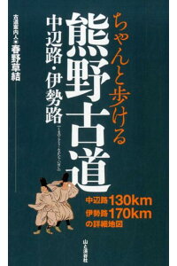
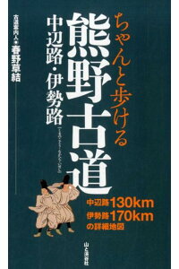
春野草結 著「ちゃんと歩ける熊野古道 中辺路・伊勢路」山と渓谷社
熊野古道を歩く研修プログラムを企画するため、少し歩いてみようと購入したのが本書です。「ちゃんと歩ける東海道五十三次」を出版している“山と渓谷社” から発行されているので、信頼できると思いました。
最初に歩いたのが、伊勢路のJR波田須駅から熊野市にある花窟屋神社までです。波田須駅自体が無人駅で、駅を出ても民家が点在するだけで人に会うことがありません。このちゃんと歩けるシリーズのマップを頼りに歩いていきます。
舗装されている道は、道標も目に付くので良いのですが、問題は樹々の生い茂る、本当の熊野古道の山道に入った時です。反対方向から来る人とすれ違うエリアだと、特に心配なく進めます、誰もいないエリアで、前方に分かれ道がある場合、どっちに行ったらいいのか、初めて来た場所では不安になります。
波田須から最初の峠、大吹峠を越した時に、道が2本に分かれていて、どっちに行くか迷いましたが、この本を見て、正しい方向を選ぶことができました。目印になる場所を漏れなく記載してくれているので、道を進みながら、正しい方向に歩いているか確認できます。
1つ難点は、タイムリーな情報、あるいは地元の人には常識となっている情報を得るのは難しいです。これらはインターネットでよく調べておいた方がよさそうです。先ほどの大吹峠を過ぎたあたりで、藪の中でガサガサ動物が動く大きな音がして、熊でも出たのかなと思い、ギョッとしました。このマップをよく読んでみると、猪垣が作られているエリアだと、後になってわかりました。読みなれないと、こういう情報は見逃すものだと感じます。
もう一つの松本峠は、緑に苔むした石段や石畳がきれいな、まさに熊野古道のイメージそのものでした。この峠は、行きかう人が多いので、迷うことはありません。それでも、マップがあると、その日の行程の内、どの程度の距離を歩いたのか、あるいはどの程度の距離が残っているのか、正確に知ることができますので、体力配分を考える上で、役に立ちます。
中辺路では、発心門王子から熊野本宮大社まで歩きました。その際は、地元のガイドさんについてもらったので、マップを見ることはなかったのですが、もし、1人あるいはガイドなしで行く場合、誰もが見たい、見晴台から拝む大鳥居は、脇道に入っていかないといけないので、その地点を正確に見つける必要があります。その際は、是非、本書を携帯して出発してください。(完)

価格:1,650円
(2021/6/19 19:14時点)
感想(4件)
Kumano Kodo, which you can walk properly, Nakahechi and Iseji (English)
Kumano Kodo: Nakahechi, Iseji (Kumano Kodo: You can walk it properly), by Haruno Kusayui, Yama-to-Keikokusha
In order to plan a training program to walk the Kumano Kodo, I bought this book to do a little walking. This book is published by Yama-to-Keikokusha, the same company that published “The Fifty-three Stages of the Tokaido Highway”, so I thought it would be reliable.
The first place I walked was from JR Hatasu Station on Iseji to Hana-no-iwaya Shrine in Kumano City. Hatasu Station itself is unmanned, and even after leaving the station, there are only a few houses scattered around, so you won’t see anyone. I walked with the help of this map from the “Walking Properly” series.
The paved road is good because you can see the signposts, but the problem is when you enter the real Kumano Kodo mountain road where the trees are growing thickly. If you are in an area where you are passing people coming from the opposite direction, you can proceed without worrying. But if you are in an empty area and there is a fork in the road ahead, you may not know which way to go, and you may feel uneasy when you first arrive.
When I passed over the first pass, Obuki Pass, from Hatasu, the road split into two and I was not sure which way to go, but this book helped me to choose the right direction. The book also lists all the landmarks, so you can make sure you’re walking in the right direction as you go along.
One drawback is that it is difficult to get timely information, or information that is common knowledge to the locals. It would be better to do some research on the Internet. Just past the Obuki Pass, I heard a loud noise of animals rustling in the bushes, which made me wonder if a bear had appeared. Reading the map carefully, I later found out that this was the area where the boar fence was built. If you are not familiar with the map, you may miss such information.
The other pass, Matsumoto Pass, was the very image of the Kumano Kodo, with its beautiful green mossy stone steps and stone pavement. There are many people passing through this pass, so it’s hard to get lost. Nevertheless, having a map is helpful to know exactly how much of the day’s itinerary you have walked and how much remains to be done, so that you can plan your fitness allocation.
In Nakahechi, I walked from Hosshinmon Oji to Kumano Hongu Grand Shrine. However, if you are going alone or without a guide, you will need to find the exact spot of the the viewing platform, from which everyone wants to see Ootorii Gate, because it is located on a side road. In that case, please carry this book with you when you leave.
Kumano Kodo, que vous pouvez marcher correctement, Nakahechi et Iseji (Français)
Kumano Kodo : Nakahechi, Iseji (Kumano Kodo : Vous pouvez le parcourir correctement), par Haruno Kusayui, Yama-to-Keikokusha.
Afin de planifier un programme d’entraînement pour marcher le Kumano Kodo, j’ai acheté ce livre pour faire un peu de marche. Ce livre est publié par Yama-to-Keikokusha, la même société qui a publié “The Fifty-three Stages of the Tokaido Highway”, j’ai donc pensé qu’il serait fiable.
Le premier endroit où j’ai marché était la gare JR Hatasu sur Iseji jusqu’au sanctuaire Hana-no-iwaya dans la ville de Kumano. La gare de Hatasu elle-même est sans personnel, et même après avoir quitté la gare, il n’y a que quelques maisons éparpillées autour, donc vous ne verrez personne. J’ai marché avec l’aide de cette carte de la série “Walking Properly”.
La route goudronnée est bonne car vous pouvez voir les panneaux indicateurs, mais le problème se pose lorsque vous entrez dans la véritable route de montagne Kumano Kodo où les arbres poussent en masse. Si vous êtes dans une zone où vous croisez des gens venant de la direction opposée, vous pouvez continuer sans vous inquiéter. Mais si vous vous trouvez dans une zone vide et qu’il y a une bifurcation devant vous, vous risquez de ne pas savoir quelle direction prendre et de vous sentir mal à l’aise dès votre arrivée.
Lorsque j’ai franchi le premier col, le col d’Obuki, depuis Hatasu, la route s’est scindée en deux et je n’étais pas sûr de la direction à prendre, mais ce livre m’a aidé à choisir la bonne direction. Le livre répertorie également tous les points de repère, ce qui vous permet de vous assurer que vous marchez dans la bonne direction au fur et à mesure que vous avancez.
L’un des inconvénients est qu’il est difficile d’obtenir des informations à jour, ou des informations connues de la population locale. Il serait préférable de faire des recherches sur Internet. Juste après le col d’Obuki, j’ai entendu un grand bruit d’animaux qui bruissaient dans les buissons, ce qui m’a fait penser à l’apparition d’un ours. En lisant attentivement la carte, j’ai découvert plus tard qu’il s’agissait de la zone où la clôture à sangliers avait été construite. Si vous n’êtes pas familier avec la carte, vous risquez de manquer cette information.
L’autre col, le col de Matsumoto, était l’image même du Kumano Kodo, avec ses magnifiques marches en pierre verte moussue et son pavé de pierre. Il y a beaucoup de gens qui passent par ce col, il est donc difficile de se perdre. Néanmoins, il est utile d’avoir une carte pour savoir exactement quelle partie de l’itinéraire de la journée vous avez parcourue et quelle partie il vous reste à faire, afin de pouvoir planifier la répartition de votre forme physique.
À Nakahechi, j’ai marché de Hosshinmon Oji au Grand sanctuaire de Kumano Hongu. Toutefois, si vous y allez seul ou sans guide, vous devrez trouver l’emplacement exact de la plate-forme d’observation, d’où tout le monde veut voir la porte Ootorii, car elle est située sur une route secondaire. Dans ce cas, veuillez emporter ce livre avec vous lorsque vous partirez.
